Trump Posts Map Showing Canada, Mexico and Greenland Under U.S. Flag, Sparking International Backlash
The president’s provocative Truth Social post depicts a dramatically expanded United States stretching across North America and beyond, prompting diplomatic protests while raising fresh questions about Trump’s territorial ambitions.
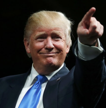
WASHINGTON, Sept. 15, 2026 — President Donald Trump has reignited international controversy after sharing a map depicting Canada, Mexico, Greenland, Iceland and other territories covered by the American flag.
Trump posted the image on his Truth Social account over the Labor Day weekend without providing a caption or explanation of what the dramatically altered map was intended to represent.
The illustration showed the United States stretching across much of North America, with stars and stripes covering neighboring Canada and Mexico as well as Greenland and Iceland in the North Atlantic.
The map went considerably further than those four territories, extending American colors across Central America and several Caribbean nations and islands, including Cuba and other parts of the Antilles.

Across the enormous flag-covered territory appeared the label “United States of America,” giving the image the appearance of a hypothetical dramatically expanded American nation rather than the existing United States.
Trump did not accompany the post with legislation, an executive order or a formal foreign-policy announcement, making it important to distinguish the provocative graphic from an actual annexation plan.
The White House has not announced a formal initiative to absorb the countries depicted on the map, and the image itself does not change any international borders or territorial sovereignty.
Still, the post attracted particular attention because Trump has repeatedly discussed expanding American territory during his second presidency, especially through proposals involving Canada and Greenland.
Trump has frequently suggested Canada should become America’s 51st state, rhetoric that Canadian leaders have consistently rejected while defending their country’s sovereignty and independence from the United States.
The president has also pursued U.S. control of Greenland, the vast self-governing territory within the Kingdom of Denmark, arguing that American ownership would strengthen national and Arctic security.
Earlier this year, Trump said full American ownership of Greenland was psychologically important to him, despite existing agreements already giving Washington substantial opportunities for military cooperation on the island.
Greenlandic and Danish officials have repeatedly rejected the idea, emphasizing that Greenland’s future must ultimately be determined by Greenlanders rather than decided by Washington or another foreign government.


The latest map produced an especially sharp diplomatic reaction from Iceland, another NATO ally whose territory appeared covered by the American flag despite having received far less attention in Trump’s earlier expansion rhetoric.
Iceland’s government summoned U.S. Ambassador Billy Long after the post, telling him that depicting the independent Nordic country as American territory was unacceptable and inappropriate, Reuters reported.
Icelandic Prime Minister Kristrún Frostadóttir went further, reportedly calling the post “ridiculous” and describing it as an insult to Icelanders, Canadians and Greenlanders.
Denmark also criticized the graphic. Foreign Minister Lars Løkke Rasmussen described it as disturbing and inappropriate, arguing it reflected what he characterized as a continuing maximalist vision from Trump.
The diplomatic response demonstrates how a social-media image can have consequences even without corresponding government action, particularly when posted by a president who has previously discussed territorial expansion publicly.
Mexico presents another important distinction. Although the latest map depicts Mexican territory beneath the American flag, Trump has not announced a formal proposal to annex Mexico into the United States.
His administration has instead focused heavily on border security, migration, drug trafficking and trade relations with Mexico, making the map substantially more expansive than previously announced U.S. policy toward its southern neighbor.
Trump’s post also follows a series of unusual geographic and naming proposals that have become a recurring feature of his second presidency and his political communication on social media.
One day before sharing the continental map, Trump posted another graphic suggesting New Mexico could be renamed “New America,” although a president cannot unilaterally change the name of a U.S. state.
Trump also recently referred to Lake Ontario as “Lake America,” following his earlier federal directive to use “Gulf of America” for the Gulf of Mexico in U.S. government communications.
The latest map therefore combines several themes that have appeared throughout Trump’s presidency: territorial expansion, geographic renaming, American economic dominance and an unusually provocative approach to communicating foreign-policy ideas.
Critics see the imagery as unnecessarily antagonistic toward allies, while Trump’s supporters have often interpreted his unconventional posts as political messaging, negotiating tactics or deliberately provocative humor rather than literal policy proposals.
Whatever Trump intended, the international response demonstrates that foreign governments are treating at least some of the imagery seriously enough to issue public objections and, in Iceland’s case, summon an American ambassador.
Comments (0)
Loading comments...
May You Like


Obama Steps Back Into the Political Spotlight as Democrats Target Trump’s Senate Majority