UN Backs Map Reform to Show Africa’s True Size, With U.S. as Sole Opponent
The U.N. General Assembly has overwhelmingly endorsed a resolution encouraging the use of more accurate world-map projections, challenging the centuries-old Mercator map that makes Africa and other equatorial regions appear smaller than they are.
The United Nations General Assembly has backed an African-led campaign to change the way the world is represented on maps, approving a resolution that promotes projections designed to show the relative size of continents more accurately.
The resolution, introduced by Togo on behalf of the African Group and supported by the African Union, passed on September 4 by 164 votes in favor, one against and six abstentions. The United States was the only country to vote against it.
The vote followed a campaign arguing that the widely used Mercator projection, created in the 16th century, significantly exaggerates the apparent size of regions closer to the North and South Poles while making equatorial regions such as Africa appear disproportionately small.
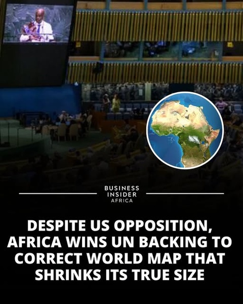
The social-media graphic accompanying the story highlights the political significance of the vote, describing it as a victory for Africa despite U.S. opposition.
But the U.N. decision does not mean that the Mercator map has been banned or that every map in the world must immediately be replaced.
Instead, the resolution encourages governments, schools, international organizations and technology companies to consider equal-area projections, including the Equal Earth projection, when accurately communicating the relative size of continents is important.
Why Africa Looks Smaller on the Mercator Map
The Mercator projection was developed by Flemish cartographer Gerardus Mercator in 1569. Its primary purpose was navigation.
One of its key advantages is that it preserves direction in a way that makes it useful for sailors plotting routes across the oceans. But that benefit comes with a major geographical trade-off: land areas become increasingly enlarged as they move away from the Equator.
That distortion is particularly obvious when comparing Africa and Greenland.
On a conventional Mercator map, Greenland can appear almost comparable in size to Africa. In reality, Africa is roughly 14 times larger than Greenland.
North America and northern Europe are also visually enlarged compared with countries and continents closer to the Equator.
The problem, therefore, is not that the Mercator projection is mathematically “wrong.” Rather, it was designed to preserve characteristics useful for navigation rather than to provide an accurate comparison of land areas.
The Equal Earth Alternative
The map promoted by the African-led campaign is known as Equal Earth.
Developed in 2018 by cartographers Tom Patterson, Bojan Šavrič and Bernhard Jenny, Equal Earth is an equal-area projection. Its main purpose is to preserve the relative size of landmasses more accurately.
On an Equal Earth map, Africa occupies a much larger proportion of the global map than it does on a standard Mercator projection, while Greenland, Canada, Europe and other high-latitude regions appear smaller.
The Equal Earth projection does not eliminate every form of distortion. No flat map can perfectly reproduce the surface of a spherical planet. Different projections inevitably compromise area, shape, distance or direction to varying degrees.
That is why the U.N. resolution does not mandate a single map for every purpose.
An African-Led Campaign
Togo played a leading role in bringing the issue to the General Assembly, building on a broader campaign supported by the African Union.
Togolese Foreign Minister Robert Dussey argued that maps are more than technical representations of geography because they influence education and people's perceptions of the world.
In remarks introducing the resolution, Dussey stressed that the initiative was not intended to attack any country or abolish the Mercator projection. He said it was designed to encourage more accurate representations of continental land areas while recognizing that different map projections serve different purposes.
The resolution itself describes the issue in terms of improving geographic accuracy and representation, particularly concerning Africa.
Supporters say the change could eventually influence school textbooks, educational materials, media graphics and digital mapping services.
Togo has said it intends to update its own school geography materials and encourage other governments and technology companies to consider similar changes.
Why Did the United States Vote Against It?
The overwhelming vote was not completely without controversy.
The United States was the sole country to vote against the resolution.
The U.S. representative argued that the initiative was part of a broader ideological agenda and criticized the General Assembly for focusing on the issue rather than what Washington considers more pressing international challenges. The U.S. described the resolution as contributing to what it sees as a loss of credibility at the United Nations.
The opposition did not prevent the resolution from passing by a huge margin.
Six countries — Estonia, Georgia, Lithuania, Moldova, Serbia and Ukraine — abstained.
Ukraine Raised a Separate Concern
The vote also revealed that even a seemingly technical debate over map projections can intersect with geopolitics.
Ukraine said it supported the broader goal of improving cartographic accuracy but abstained because of concerns about how some Equal Earth maps depict territories occupied by Russia.
Ukraine argued that map representations should not create ambiguity about internationally recognized borders or territorial sovereignty.
The European Union subsequently emphasized that the resolution was concerned with the relative size of landmasses, not sovereignty, territorial status or international borders.
That distinction is important: the U.N. resolution does not redraw national borders or recognize territorial claims.
France Also Moves Away From Mercator
The debate has gained momentum beyond Africa.
France announced shortly before the U.N. vote that it would move away from Mercator for its world maps and use the Eckert IV projection, another equal-area projection that represents equatorial regions more proportionally.
The decision illustrates a broader discussion among governments and institutions about whether the projection used in educational and public-facing maps should prioritize area accuracy rather than the navigational advantages of Mercator.
What the Viral Graphic Gets Right — and What It Leaves Out
The graphic is substantially accurate about the central event: Africa and its allies succeeded in winning overwhelming U.N. backing for a resolution promoting more accurate representations of continental size, and the United States was the only country to oppose it.
However, several points require clarification.
The U.N. did not ban the Mercator projection. The resolution is nonbinding and does not force countries, companies or schools to replace every existing map.
The Equal Earth map is not a brand-new map created by the U.N. It was developed in 2018, years before the 2026 General Assembly vote.
Africa is not literally being “made bigger.” Equal Earth changes the way the spherical Earth is projected onto a flat surface so that relative land areas are represented more faithfully.
And Mercator is not useless. It remains valuable for navigation precisely because of the characteristics that cause its land-area distortions. The U.N. resolution explicitly recognizes the continued usefulness of different projections for different purposes.
A Map Can Shape How the World Is Seen
The significance of the U.N. vote ultimately goes beyond cartography.
For centuries, the Mercator projection has been one of the most recognizable visual representations of the planet. Its distortions have become so familiar that many people do not realize how dramatically the apparent sizes of continents change depending on the projection.
The new U.N. resolution does not change the geography of Earth. Africa was always as large as it is today.
What it seeks to change is the way that geography is communicated.
The vote therefore represents both a technical discussion about cartography and a broader African effort to challenge historical representations of the continent.
As governments, schools and technology companies consider whether to adopt equal-area maps, the debate is likely to continue — not over whether the Earth has changed, but over which version of the Earth people should see when they look at a map.
Comments (0)
Loading comments...
May You Like

Jack Smith Defends His Integrity as Trump Investigations Face Renewed Political Firestorm
OBAMA STUNS ON INSTAGRAM: MESSAGE MARKING 34-YEAR MILESTONE SPARKS A BUZZ